Annual Cross-Island Hike
The land bank celebrates National Trails Day — the first Saturday of June
What is the XIH?
Each year since 1993, the land bank has observed National Trails Day — the first Saturday of June — by conducting a day-long hike across the island to expose people to the network of trails that connect the island’s many conservation lands and public properties. Usually the hike will include sections along dirt or paved roads, but sometimes may include shorelines, steep grades and sections of overgrown vegetation (possibly including poison ivy). Hikes sometimes include stretches across private properties with the generous permission of the owners for the day of the hike only. This is a day-long, guided hike that differs each year and is ordinarily less than 20 miles in length and most participants elect to walk only a portion of the hike’s route, using the itinerary times and information provided on this website to plan their personal starting and ending points.
The 32nd annual XIH took place on June 1, 2024 and ranged 19.2 miles from Hillman’s Point Preserve to the Chilmark Pond Preserve. Approximately 135 people participated in the cross-island trek. Some 99 started; 42 completed the entire hike. The route passed along 17 conservation properties and 5 named ancient ways.
The next XIH will take place on Saturday, June 7, 2025.
What to Expect
This is not a guided nature walk. Due to the length of the hike, the pace is briskly led. The hike leader marks turnoffs and intersections with colored tape for hikers to follow. About every hour, the hike’s leader will pause a few minutes to provide opportunities for slower hikers to catch up. Hikers are encouraged to walk at their individual comfort levels. Most participants opt to walk only a portion of the route. Approximated times and distances for segments of the hike are provided with the map of the route to help people plan how they wish to be part of the hike.
Sturdy shoes, water bottles, insect repellent and sunscreen (or rain gear) are recommended. Well-behaved, leashed dogs are welcome, unless otherwise noted.
There is a 30-minute lunch break and 15-minute breaks mid-morning and in the afternoon. Hikers are responsible for their own food and water. To augment hikers’ provisions, the land bank normally has some fruit and water at the morning and afternoon breaks. Efforts are made to have restrooms available at the breaks, but this is not always possible. Restroom availabilty will be identified in the hike’s details.
Long hikes always have to cross roadways and frequently require walking alongside some roads for extended stretches. Hikers need to remain alert.
Transportation to and from the hike is the responsibility of the participants. Parking is often very limited at starting and ending points. Please check the VTA bus schedules.
Details as to the most recent XIH follow:
2025 Cross-Island Hike
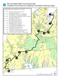
This year’s hike begins at Chilmark Pond Preserve and concludes 18.2 miles to the northeast at the Tisbury portion of Eastville Point Beach. The hike starts at 8:15 AM and finishes at 3:20 PM. Participants should use the checkpoints on the 2025 XIH map to determine which part(s) of this year’s hike best suits their schedules, interests, and physical capabilities.
Twenty-three conservation properties (land bank properties, unless otherwise noted) and five ancient ways (AW) are included in this year’s hike:
Chilmark Pond Preserve Iron Hill Farm
Ocean View Farm Preserve Benjamin Luce Road (AW)
Middle Road Sanctuary (SMF) Weahtaqua Springs Preserve
Meeting House Road Association Old Holmes Hole Road (AW)
King’s Highway (AW) Old Back Road to Oak Bluffs (AW)
Ridge Road (AW) Featherstone Farm
Brookside Ridge Preserve (SMF) Southern Woodlands Reservation
Tiasquam Valley Reservation Bayes Hill Property Association
Brand Bow (Town of WT) Lagoon Ridge subdivision
Mill Pond Overlook (Town of WT) Vineyard Hills HOA
Manuel F. Correllus State Forest Sailing Camp Park (Town of OB)
Margaret K. Littlefield Greenlands (Town of WT) Lobster Hatchery (MA Fish and Game)
Little Duarte’s Pond Preserve/I.G.I Doug’s Cove Preserve
Wapatequa Woods Reservation Eastville Point Beach (Town of Tisbury)
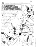
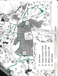
This map shows the route of the hike.
The early portions of the hike (segments A-B and B-C) traverse hilly terrain, some quite steep. Section E-F is an extended jaunt through the State Forest and Greenlands. The last leg of the hike is along the Lagoon Pond shoreline where, in addition to the footing challenges of cobbles and soft sand, there is an inlet to Brush Pond that must be crossed. The width and depth of the crossing varies with shoaling. The tide will be low at the time of the hike but participants in this segment should plan on at least 4-to-6-inch deep water for several places. Unless you have your Wellies, plan on your feet getting wet, whether covered or exposed.
The lunch break at the West Tisbury town hall is about one-third into the hike, and the afternoon break at Wapatequa at nearly two-thirds. Bathroom facilities will be at both locations.
Parking is limited at Chilmark Pond and the single lane driveway from South Road is a chokepoint for cars dropping off participants. Participants may consider being dropped off safely on the wide shoulders of South Road or arrive by VTA bus #5 from the West Tisbury town hall. The town hall is a VTA hub connecting to the down-island towns. There is frequent bus service at Eastville Beach.
Well-mannered, leashed dogs are welcome to accompany their owners.
The hike route will also be available on the TrailsMV app, so participants can monitor their progress.
Questions about the XIH can be sent to Bill Veno at bveno@marthasvineyardlandbank.com
Previous Hikes:
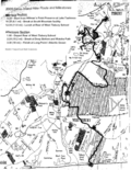
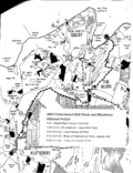
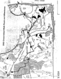
Below is a list of the XIHs since they started in 1993 and links to maps from several of those hikes. For some years, only the morning or afternoon segment is provided. Only hikes and segments not involving any special permissions from landowners have been selected. We hope these will provide ideas for people to explore or redo portions of previous hikes, or to string together their own customized hike of whatever distance. Mapping has changed over the years. The early maps were just notes for land bank staff conducting the hikes. It was not until 2008 that maps were made for participants. People are cautioned to check the current land bank map or the TrailsMV trail app to verify the trail routes as they exist today. Enjoy the outdoors!
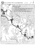
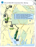
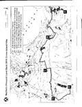
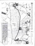
Maps from Previous Hikes
List of Previous Hikes
| Year | Start and Finish Points | Miles |
|---|---|---|
| 1993 | Lucy Vincent Beach to Bend in the Road Beach | 20 |
| 1994 | Katama Beach to Ocean Park | 19 |
| 1995 | Menemsha Beach to Vineyard Haven Harbor | 27 |
| 1996 | Katama Point to Eastville Point Beach | 23 |
| 1997 | West Chop Lighthouse to East Chop Lighthouse | 25 |
| 1998 | Edgartown Great Pond to Cedar Tree Neck | 19 |
| 1999 | Chilmark Pond to Wilfrid’s Pond | 19.7 |
| 2000 | Pecoy Point to Great Rock Bight | 21 |
| 2001 | Edgartown Lighthouse to Lambert’s Cove Beach | 17.9 |
| 2002 | North Neck to Quenames Beach | 20.5 |
| 2003 | Lucy Vincent Beach to Eastville Beach | 19.1 |
| 2004 | Bend in the Road Beach to Hillman’s Point | 16 |
| 2005 | Hillman’s Point to Long Point | 14.5 |
| 2006 | Long Point to Jetty Beach | 16.3 |
| 2007 | Jetty Beach to Blackwater Pond | 17.6 |
| 2008 | Blackwater Pond to Great Rock Bight | 15.2 |
| 2009 | Great Rock Bight to Felix Neck | 21 |
| 2010 | Quammox to Quansoo | 19 |
| 2011 | Sepiessa Point to Wilfrid’s Pond | 14.6 |
| 2012 | Wilfrid’s Pond to Katama Point | 18.2 |
| 2013 | Katama Point to Lambert’s Cove Beach | 18.6 |
| 2014 | Lambert’s Cove Beach to Chilmark Pond | 16.8 |
| 2015 | Chilmark Pond to Pecoy Point | 20 |
| 2016 | Pecoy Point to South Beach | 21.1 |
| 2017 | South Beach to Menemsha Beach | 25 |
| 2018 | Menemsha Beach to Blackwater Pond | 17.2 |
| 2019 | Blackwater Pond to State Beach at Big Bridge | 16.2 |
| 2020 & 2021 | Canceled due to COVID | |
| 2022 | Big Bridge at State Beach to Long Point | 21 |

