Peaked Hill Reservation
Size
148.9 acres
Description
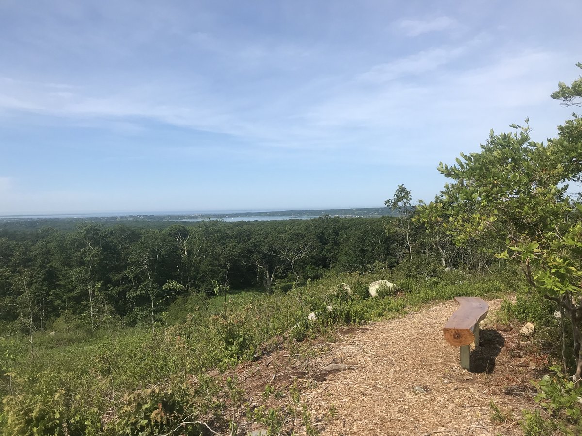
The rise of land known as Peaked Hill is the island’s summit. The highest point in the rise, 311 feet above sea level, has quietly reposed for years; its 308’ cousin, located almost a quarter of a mile away, is renowned on the island as a World War II military lookout and garrison. The various promontories enjoy vistas of the south shore, Nomans Land Island, the Aquinnah peninsula, Menemsha Bight and — in the far distance over the Vineyard Sound, Elizabeth Islands and Buzzards Bay — the Mattapoisett coast. Boulders are strewn about, including the Wee Devil’s Bed and Stonecutter’s Rock. Big bluestem, an attractive native grass, is gaining a foothold here.
Universal Access
- Difficulty rating: Difficult
- Trail: 1 UA parking space located on Radar Hill off Middle Road leads to 400’ hardened trail. Pasture Road trailhead has walking access on old road with small sections of grade for 1,000’ to Peaked Hill summit
- Points of Interest: Panoramic views of the south shore and remnants of old military bunkers. Access from Pasture Road trailhead offers glacial erratic viewing and expansive views at summit of Peaked Hill
- Benches: 4
Access
Start at the Middle Road - Tabor House Road intersection. Proceed up the Tabor House Road 0.5 miles and turn left onto Pasture Road. Stay on Pasture Road past Basswood Lane and then turn right. Turn right again 0.1 miles later, at the fork; long driveway leads to land bank trailhead. For universal-access trailhead, start at the Middle Road - Tabor House Road intersection and travel on the Middle Road in the direction of Beetlebung Corner 0.8 miles; turn right here and follow road to the top of the hill.
Historical Highlights
- the site at Radar Hill is well-known for its use as a United States Army Signal Corps station during World War II and as a radar installation following the war, from 1952 to 1959
- evidence of this use remains in the form of concrete foundations, chain link fences, foxholes, mortar pits, machine gun nests, metal fencing, a concrete bunker and other fortifications
