Caleb’s Pond Preserve
Size
3.0 acres
Description
A sound public policy goal in an aquatic region is to seek to supply at least one access to each of its major ponds. At the time of the land bank’s chartering in 1986 a number of Vineyard ponds — Cape Poge, Chilmark Lower, Edgartown Great, James, Squibnocket, Tisbury Great — lacked general public access. Diligence, not to fail to mention patience, paid off for these ponds over the course of the following decades; Caleb’s Pond’s turn came in 2020. The land bank’s three acres here bring visitors to 175 feet of shoreline. The land bank will continue to work with the town conservation commission to arrange for future boating access; most all other types of passive recreation are currently available.
Universal Access
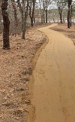
Difficulty rating: Easy
Trail: Trail surface is compacted crushed native stone dust
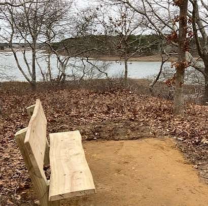
Points of Interest: Pond - an easily traversed trail that ends at a bench with expansive
views of Caleb’s Pond
Benches: 1
Access
Begin at where the Chappaquiddick and Litchfield Roads intersect. Travel down the latter and look for the land bank logo sign, on the right, just shy of 0.3 miles from the intersection.
Historical Highlights
● some early deeds refer to Collops Pond; "collop" means a "piece of meat" and the pond’s shape is that of a chop
● in 1857 the Caleb's Pond Fishing Company petitioned the commonwealth for permission to close the pond inlet at Swimming Place in order to create a fisheries operation
